

SJ-NTU Corporate Lab: Compound Flooding Flood Resiliency Platform
Storm surges or extreme rainfall precipitation can do devastating damage on their own. A combination of the two, termed compound flooding, can create higher flood levels, prolonged flooding events and reach further inland than anticipated.
However, compound flooding is complex and generally not considered in current flood forecasting and prevention planning. The modelling of urban drainage and coastal flooding is typically done by separate software, and would not be a good assessment of the severe flood risk affecting coastal cities, especially with the rising sea levels and higher frequency of extreme rainfall or storm surge events due to climate change.
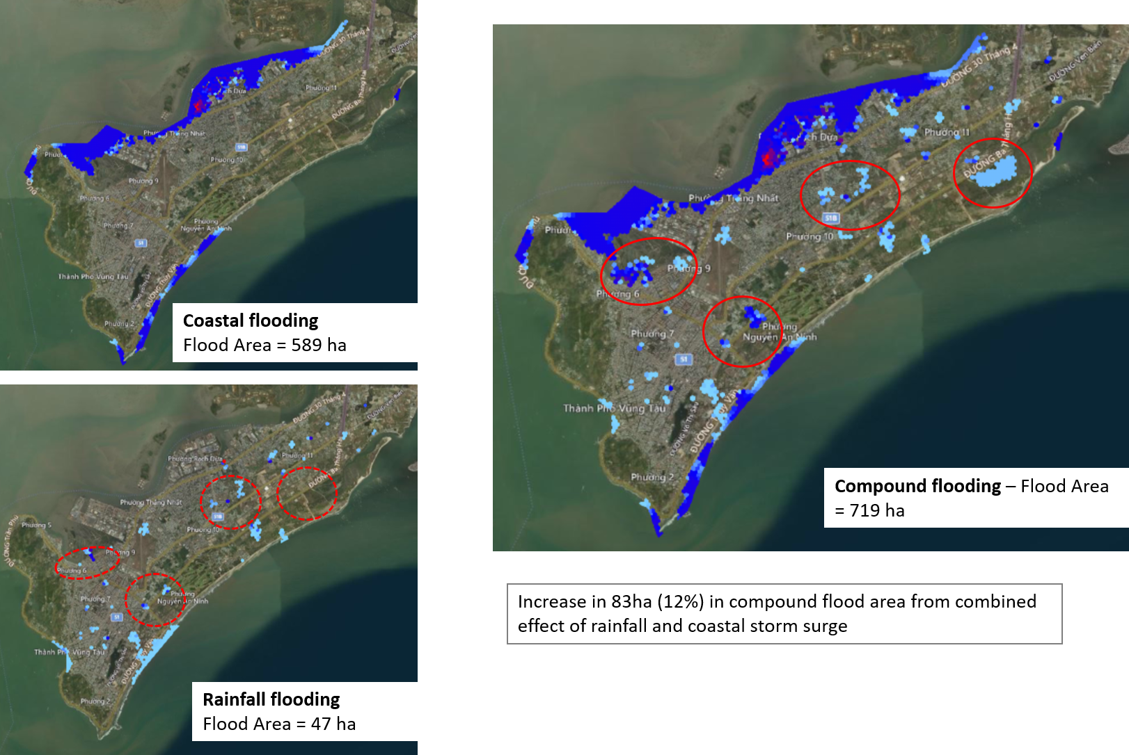
The SJ-NTU Corporate Lab Flood Resiliency Project has developed a 3D Compound Flooding model to determine the complex joint effects of heavy precipitation and storm surges. The compound flooding model will seamlessly integrate 3D near shore coastal process models with 2D urban catchment models, to enable forecasting of flooding risks due to a combined impact of precipitation and storm surges. An example of the modelling results for a city in Vietnam is shown in Figure 2, where the compound flood has a more severe flood impact (12% increase in total flood area) than the summation of individual rainfall and coastal flood modelling that is typically performed.
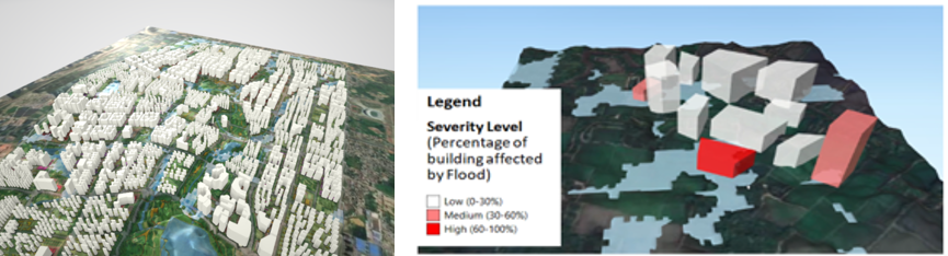
The flood results would incorporated into a 3D visualisation platform (Figure 3), that is integrated with the building information. This allows for a clear overview of the buildings/assets that will be affected by the flood water propagation and allows for an efficient urban planning design against flood mitigation.
Subsequently, the model would incorporate data from smart sensor technologies, for example, land-based rain gauges, weather radar, wave height buoys, to enable the real time forecasting of flood risks to facilitate real time flood risk prediction. It will also be integrated with transportation to quantify and visualise flood-induced traffic congestion and recommend possible solutions that might be implemented to reduce traffic congestion, and suitable for use globally. This model will be highly relevant to dense buildup cities that is susceptible to large social and economic losses from flooding due to infrastructure damages and transportation standstill.